Love the idea of waking up to wide Ohio River views, but unsure how flood maps, insurance, and the nearby port shape day-to-day life? You are not alone. Riverfront living in Mount Vernon can offer a rare mix of scenery, recreation, and small-city convenience, yet it comes with real considerations. In this guide, you will learn what to expect in ZIP 47620, how to check flood zones and insurance basics, and how to approach buying or selling with confidence. Let’s dive in.
Mount Vernon at a glance
Mount Vernon sits along the Ohio River near the Wabash–Ohio confluence and is the county seat of Posey County. The U.S. Census counted 6,493 residents in the 2020 decennial census, which helps frame the city’s small-community scale and services you can expect nearby. You can review the latest official data through the U.S. Census Bureau’s QuickFacts for Mount Vernon city, Indiana.
- Population context: U.S. Census QuickFacts for Mount Vernon
The Ports of Indiana–Mount Vernon is a major riverport and logistics hub adjacent to the city. That industrial presence is a key part of the local economy and influences which stretches of waterfront are residential, recreational, or industrial. If you plan to live near the river, understanding port activity and nearby corridors is important for daily quality of life.
- Local economy and port: Ports of Indiana – Mount Vernon
Riverfront lifestyle and access
If you enjoy time on the water or in the woods, you will find a standout public resource just southwest of town. The Hovey Lake Fish & Wildlife Area spans roughly 7,400 acres of bottomland and includes a 1,400-acre oxbow lake. You get a DNR-maintained boat ramp, access to the Ohio River, and year-round opportunities for fishing, paddling, wildlife viewing, and regulated hunting. Seasonal restrictions and draw schedules can apply, so always check the DNR page or call the property office before you go.
- Recreation hub: Indiana DNR – Hovey Lake Fish & Wildlife Area
Neighborhood character on the river
Mount Vernon’s riverfront features a mix of public recreation areas, historic downtown frontage, and port or industrial facilities. That mix creates very different experiences block to block. In some locations you may enjoy quiet river views and a walkable downtown feel, while in others you will notice truck or rail activity and related noise.
Local planning documents identify the downtown riverfront as an area with redevelopment potential. Community goals often balance flood control, public access, and ongoing industrial use. If you are comparing addresses, it helps to look closely at nearby land uses and traffic patterns.
- Riverfront planning context: Mount Vernon Comprehensive Plan
Touring tips for river-adjacent streets:
- Walk the block at different times of day to note traffic and port-related activity.
- Ask about typical high-water clean-up in that area and whether streets or driveways see temporary closures.
- Check where the nearest river access, park space, and downtown amenities sit relative to your home.
Flood risk essentials
Flood risk is the single most important technical factor to understand with riverfront property. FEMA’s Flood Insurance Rate Maps, accessed through the Map Service Center, are the starting point for address-specific zones and for many lender requirements.
- Map lookup: FEMA Map Service Center
For historical context, the National Weather Service maintains a river gauge for the Ohio River at Mount Vernon. It lists recorded crests, including the 1937 record and large events in more recent years. This information helps you understand general river behavior, though it should not be used to estimate depth on any specific lot without professional data.
- River behavior: NWS AHPS – Ohio River at Mount Vernon
Flood insurance basics you should know:
- If a home with a federally backed mortgage is in a FEMA-mapped Special Flood Hazard Area, lenders typically require flood insurance.
- Coverage is available through the National Flood Insurance Program and many private carriers.
- Costs are highly property specific. Always request a quote that reflects the structure, elevation, and mitigation features.
Permits and local rules
Posey County and the City of Mount Vernon enforce floodplain management and building rules tied to FEMA maps and state regulations. Development in floodways may require approval from the Indiana Department of Natural Resources. Before you plan improvements, contact the local floodplain administrator to confirm permit needs, the flood protection grade, and any variance procedures.
- Local rules and permitting: Posey County Consolidated Zoning & Floodplain Ordinance
Map changes and elevation certificates
If a property sits on naturally higher ground or has been elevated with engineered fill, you may be able to seek a formal FEMA map change. Processes include LOMA, LOMR, and LOMR-F. These require professional documentation, such as an elevation certificate, and FEMA review that can take weeks or months. Your surveyor or engineer can advise on feasibility and the steps involved.
- FEMA guidance on LOMA/LOMR: Change Your Flood Zone
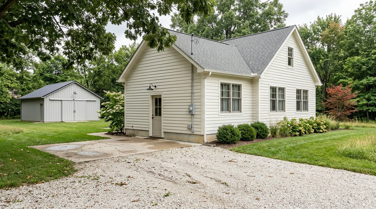
Homes and pricing in 47620
Mount Vernon’s housing stock is predominantly single family, with many homes built before 1970 and through the mid-century period. A smaller share of dwellings sits close to the historic downtown riverfront, while other waterfront tracts are in industrial or conservation uses like bottomland areas. The city’s comprehensive plan is a helpful reference for age mix and where housing clusters.
- Planning and housing context: Mount Vernon Comprehensive Plan
For price context, recent consumer snapshots place the ZIP 47620 median home value around approximately $219,000. Treat this as a ballpark figure only and ask for current MLS data when you are ready to make an offer or set a list price. MLS data will always be more precise for timing and condition.
- Market snapshot: ZIP 47620 median value overview
Riverfront trade-offs
Pros you may value:
- River views and distinctive character.
- Quick access to boating, fishing, birding, and nature.
- Proximity to major river infrastructure and downtown amenities.
Cons to plan for:
- Elevated exposure to flooding and flood-related maintenance.
- Potentially higher flood-insurance premiums in mapped hazard areas.
- Occasional noise or truck and rail traffic near port corridors.
- A smaller buyer pool for properties with higher hazard ratings.
Buyer checklist for riverfront
Use this quick list as you compare addresses:
- Verify the flood zone at the FEMA Map Service Center. Save the panel and effective date for your records.
- Request a flood insurance quote tied to the exact structure. Ask whether any elevation certificate or mitigation feature could affect pricing.
- Ask the seller for any elevation certificate, Letters of Map Change, or permits on file.
- Review past high-water history and typical clean-up needs for the lot and street.
- Budget for mitigation, such as elevating utilities, adding or maintaining flood vents, or bank stabilization where allowed. Confirm permits with the local floodplain administrator and state regulators.
Seller tips for riverfront listings
Clear, complete disclosures build trust and reduce surprises. Indiana requires sellers of most 1–4 unit residential properties to complete the state Seller’s Residential Real Estate Sales Disclosure. The form specifically asks about known hazardous conditions, including flooding. Deliver it as required and keep a copy for your file.
- Seller disclosure: Indiana State Form 46234
Smart prep can also help your listing stand out. Gather any elevation certificates, flood-insurance history, and documentation of mitigation work. Set pricing with current MLS comparables and communicate the lifestyle benefits along with practical flood information. With The Realty Collective’s local expertise and national-level marketing, you can pair transparent data with strong presentation.
Posey County context
Within Posey County, Mount Vernon is the largest river town, anchored by the Port and nearby Hovey Lake. Other communities, including New Harmony and places near the Wabash and Ohio floodplains, have smaller residential footprints and in some blocks a higher share of mapped floodplain. If you are comparing across communities, review the relevant FIRMs and local resources to see how the floodplain interacts with housing.
- County context: Mount Vernon Comprehensive Plan
Work with a local guide
Buying or selling near the river takes practical know-how, responsive communication, and clear data. The Realty Collective pairs neighborhood insight with @properties’ distribution so your listing or offer gets the right visibility. Our team’s production and capacity give you confidence at each step, while our consultative approach keeps the process clear and calm.
Ready to talk strategy for a Mount Vernon riverfront move or valuation? Connect with Marc Hoeppner for a local, data-informed plan that fits your goals.
FAQs
What is riverfront living like in Mount Vernon?
- You will find a mix of scenic residential blocks, public river access, and nearby port or industrial activity. The exact feel varies block to block, especially near downtown and logistics corridors.
How do I check if a Mount Vernon address is in a flood zone?
- Look up the address on FEMA’s Map Service Center, note the panel and effective date, and contact the local floodplain administrator with questions on permits or compliance.
Will my lender require flood insurance near the Ohio River?
- If the home is in a FEMA Special Flood Hazard Area and your mortgage is federally backed, lenders typically require flood insurance. Always get a property-specific quote.
Can a home be removed from a FEMA flood zone?
- Possibly. If a site is on natural high ground or has engineered fill, you can pursue a LOMA or LOMR with professional documentation and FEMA review.
Who approves riverbank or floodplain work in Posey County?
- Start with the local floodplain administrator for permit requirements. Work in regulated floodways may also require Indiana DNR approval.
Do Indiana sellers have to disclose past flooding?
- Yes. Indiana’s Seller’s Residential Real Estate Sales Disclosure asks about known hazardous conditions, including flooding. Provide accurate, complete information.